GIS Analyst Resume Examples: free ATS score and gap list
Write a GIS Analyst Resume That Shows Real Spatial Work
By Mustafa Tarabya, founder of CVBooster · Published · Updated
A GIS analyst resume example with ArcGIS, PostGIS and Python detail, the data and mapping keywords reviewers scan, and a full writing guide.
Sample resumes for a gis analyst
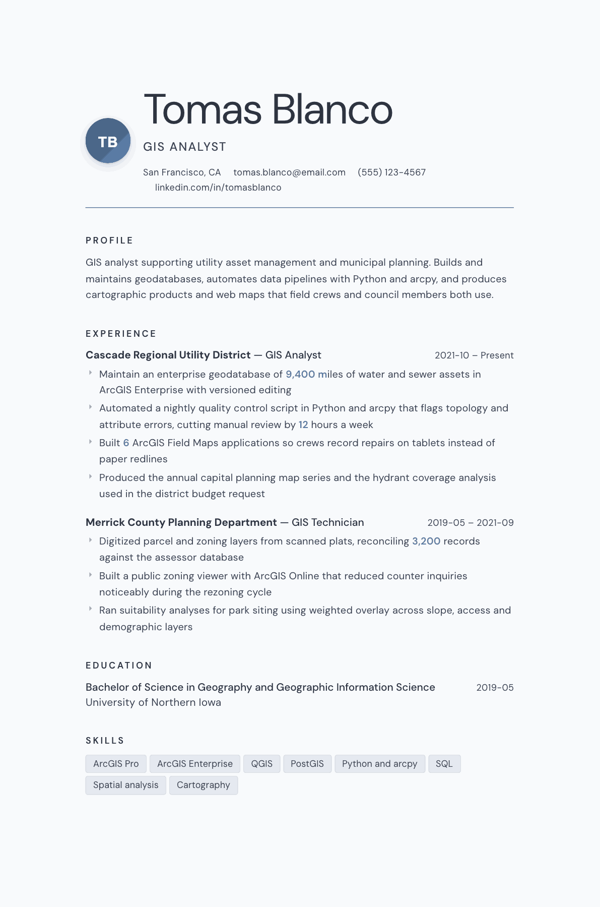
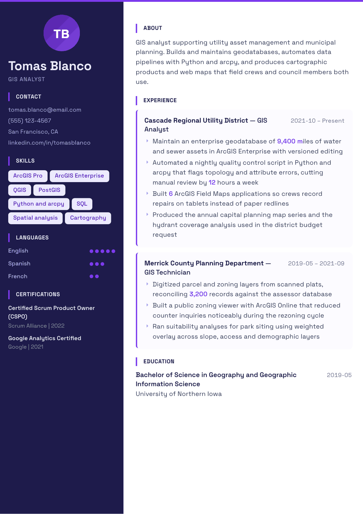
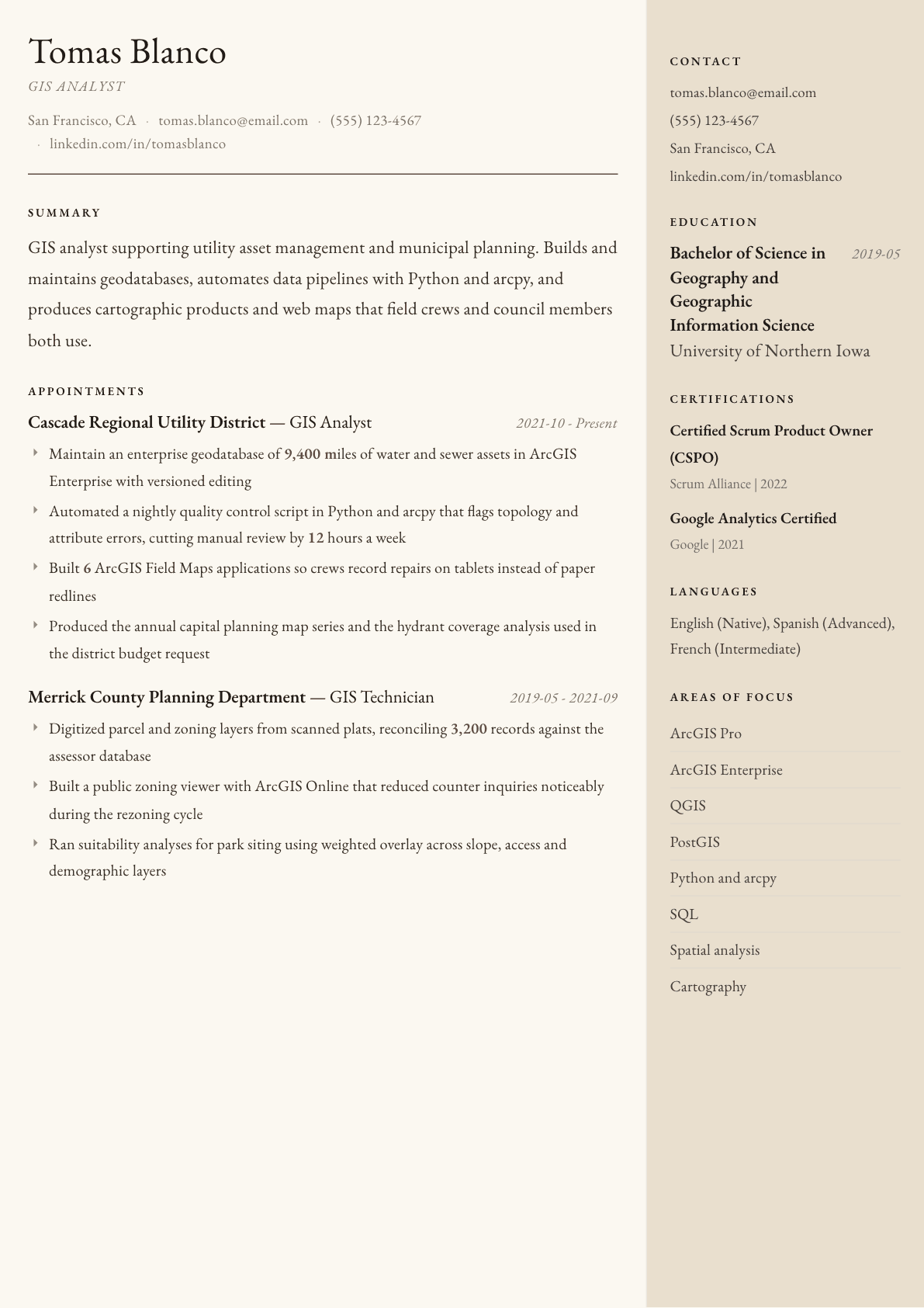
The same gis analyst content laid out in three CVBooster templates, so you can see what the finished document looks like before you write a word.
Example GIS Analyst summary
GIS analyst with five years supporting utility asset management and municipal planning. Maintains an enterprise geodatabase covering 9,400 miles of water and sewer network, automates quality control with Python and arcpy, and publishes field applications used daily by repair crews. Produces the map series behind annual capital planning decisions. Seeking a spatial analyst role with more modeling and less production cartography.
Skills to list on a GIS Analyst resume
- ArcGIS Pro
- ArcGIS Enterprise
- ArcGIS Online
- QGIS
- PostGIS
- Python and arcpy
- SQL
- Spatial analysis
- Geodatabase design
- Cartography
- Remote sensing
- LiDAR processing
- Coordinate systems
- Field Maps
- Metadata standards
- Data quality control
What actually gets this resume read
- Name the platform stack precisely, since ArcGIS Pro, ArcGIS Enterprise and QGIS shops rarely treat each other as equivalent.
- Quantify your data: feature counts, miles of network, parcels maintained, or the extent of the study area.
- Show automation with Python and arcpy, because manual digitizing alone reads as technician-level work.
- Include the analysis types you have run, such as suitability, network, hot spot or viewshed, using the standard names.
- Mention who consumed your output, whether field crews, planners, engineers or elected officials, since audience shapes the role.
- Add a line on data governance: coordinate systems, metadata standards, and quality control keep enterprise GIS teams honest.
How to write a gis analyst resume
A GIS analyst resume is usually read by a GIS coordinator or a planning manager who has seen a hundred applications that all say the same three things: proficient in ArcGIS, strong attention to detail, experience creating maps. None of that separates anyone. What separates candidates is the data they were responsible for, the analyses they ran without being handed a recipe, and whether they can automate work rather than repeat it by hand.
It matters that this job sits between two identities. Some GIS roles are production cartography and data maintenance, where the value is accuracy and throughput. Others are analytical, where the value is turning spatial data into a recommendation a decision maker acts on. Utilities, city and county government, environmental consulting, transportation and private industry all weight those differently. Your resume should signal which of the two you are, and ideally show that you can do the analytical half.
This guide covers the format, the summary, how to write experience that proves both data stewardship and analysis, the software and technique keywords that matter, and the questions analysts ask when writing this document.
Format: one page early, technical skills high on the page
Reverse chronological, one page for the first five to seven years. Put a technical skills block near the top rather than at the bottom, because GIS hiring filters hard on the software stack and a reviewer wants to confirm the platform before reading anything else. Group it, do not run it together as one paragraph.
Add a link to a portfolio or a public map gallery if you have one. Web maps, story maps and dashboards can be viewed in a browser, which makes them the strongest available evidence, and very few applicants include a link.
- Header: name, title, city, phone, email, LinkedIn, and a portfolio or map gallery link.
- Order: summary, technical skills, experience, projects, education, certifications.
- Name the platform version family you work in, since enterprise deployments differ sharply from desktop-only work.
Summary: sector, data scale, and the analysis you do unaided
Three lines. Name the sector, the data you are responsible for, and the type of analysis you run independently. Sector matters because utility asset data, parcel and zoning data, environmental sampling data and transportation networks each carry their own conventions, and a hiring manager values a candidate who already knows hers.
Include scale in the summary, expressed in the unit of your sector: miles of network, number of parcels, acres of study area, or the count of layers in the enterprise geodatabase you maintain. A number here immediately separates a professional from someone whose experience is a series of class exercises.
Experience: data stewardship, analysis, automation, and the audience
For each job, open with the environment: the platform, whether the deployment was desktop or enterprise, and the datasets you owned. Then write to four themes: what data you maintained, what analyses you performed, what you automated, and who used the output.
Data stewardship bullets should mention the discipline behind the work, not just editing. Versioned editing, topology rules, domains and subtypes, coordinate system management, metadata standards, and reconciliation against an authoritative source such as an assessor database or a work order system. These signal that you can be trusted with a production geodatabase.
Analysis bullets should use the technique names the field recognizes: suitability modeling with weighted overlay, network analysis and service areas, hot spot and cluster analysis, interpolation, viewshed, watershed delineation, change detection from imagery. Then say what decision the analysis informed. An analysis nobody used is a class assignment; an analysis that shaped a capital plan is professional work.
Automation is the fastest way to look senior. Python with arcpy, ModelBuilder chains, scheduled quality control scripts, and data pipelines that pull from a maintenance system into the geodatabase. Give the time saved or the error class caught, because that is the language a manager uses when she asks for another position on her team.
End with audience. Field crews using mobile applications, planners at a counter, engineers sizing infrastructure, or a council reading a map in a budget packet. Naming the audience shows you understand that GIS output is a product with users, which is exactly the maturity that separates an analyst from a technician.
- Say whether the deployment was desktop only or enterprise with versioned editing.
- Name analyses by their standard technique names, then the decision each one supported.
- Include one automation bullet with the language and the time or error saving.
- Name the audience for at least one product you produced.
Skills: platform, data, analysis and programming, kept separate
Four groups reads best. Platform: ArcGIS Pro, ArcGIS Enterprise and Online, QGIS, and the field applications. Data: geodatabase design, PostGIS or SQL Server spatial, SQL, imagery and LiDAR handling, coordinate reference systems, metadata standards. Analysis: the technique list above. Programming: Python and arcpy, R if you use it, and whatever web mapping libraries you have touched.
If you have web development exposure, say so plainly. Analysts who can build a dashboard or configure a web application are in shorter supply than analysts who can produce a print map, and many postings now ask for both without saying so directly.
Keywords GIS postings use
These job descriptions repeat: ArcGIS Pro, ArcGIS Enterprise, ArcGIS Online, geodatabase, versioned editing, spatial analysis, geoprocessing, arcpy, Python, SQL, cartography, georeferencing, coordinate systems, remote sensing, LiDAR, digitizing, metadata, asset management and field data collection. Mirror the true ones inside sentences about your own work, and use the exact product spellings, because recruiters searching a resume database type them exactly as the posting does.
GIS Analyst resume summary examples
New graduate
Geography graduate with a GIS certificate and an internship digitizing zoning and parcel layers for a county planning office. Comfortable in ArcGIS Pro and QGIS, wrote a Python script to batch clip and project incoming datasets, and produced the park siting suitability analysis presented to the planning commission.
Four years in
GIS analyst supporting utility asset management, maintaining an enterprise geodatabase covering thousands of miles of water and sewer network with versioned editing. Automates nightly quality control in Python and arcpy, builds field applications used daily by repair crews, and produces the map series behind annual capital planning.
GIS coordinator
GIS coordinator responsible for the enterprise platform across six departments, including data governance, publishing standards and user training. Led the migration from desktop editing to a versioned enterprise geodatabase, manages two analysts, and sets the metadata and coordinate system standards the whole organization now follows.
Work experience bullets: before and after
Before: Maintained GIS data for the utility.
After: Maintained an enterprise geodatabase of water and sewer assets covering thousands of network miles, using versioned editing and topology rules to keep field edits reconciled.
Scale plus the specific stewardship methods show a production environment rather than occasional editing.
Before: Created maps for the department.
After: Produced the annual capital planning map series and a hydrant coverage analysis that the district used to justify its infrastructure budget request.
It names the product and the decision it fed, turning cartography into work with a consequence.
Before: Used Python for GIS tasks.
After: Automated a nightly quality control routine in Python and arcpy that flags topology breaks and attribute violations, replacing about twelve hours of manual review each week.
The specific error classes and the hours recovered make the automation measurable instead of decorative.
Before: Built web maps for field staff.
After: Built six field applications so repair crews record work on tablets against the live asset layer, ending the paper redline backlog that previously delayed data updates.
Naming the users and the workflow it replaced shows the deliverable changed how the organization operates.
Before: Performed spatial analysis for planning projects.
After: Ran weighted overlay suitability analysis across slope, transit access and population layers to rank candidate park sites, and presented the ranked results to the planning commission.
The technique, the input layers and the audience prove independent analytical work rather than following a template.
Hard skills
- ArcGIS Pro
- ArcGIS Enterprise and Online
- QGIS
- Geodatabase design and versioned editing
- PostGIS and spatial SQL
- Python and arcpy
- Spatial analysis and geoprocessing
- Cartographic production
- Remote sensing and imagery analysis
- LiDAR processing
- Coordinate reference systems
- Field data collection applications
Soft skills
- Translating spatial results for non-technical audiences
- Data quality discipline
- Requirements gathering with departments
- Training field and office users
- Project documentation
Certifications worth listing
- GIS Professional (GISP) (GIS Certification Institute)
- ArcGIS Pro Foundation Associate (Esri)
- ArcGIS Pro Professional (Esri)
- Certified Mapping Scientist, Remote Sensing (American Society for Photogrammetry and Remote Sensing)
Mistakes that cost gis analyst candidates the interview
- Writing proficient in ArcGIS with no indication of whether the work was desktop editing or enterprise administration.
- Describing maps produced without ever saying what decision or document they supported.
- Leaving out data volume, so a reviewer cannot distinguish a class project from a production asset layer.
- Skipping automation entirely, which caps you at technician level even when your analysis work is strong.
- Listing spatial analysis as a phrase rather than naming the techniques a GIS coordinator would recognize.
- Ignoring metadata, coordinate systems and quality control, which are the first things a data manager asks about.
GIS Analyst resume questions
What is the difference between a GIS analyst and a GIS technician on a resume?
A technician resume is built on production: digitizing, editing, map output and data entry. An analyst resume adds independent analysis and automation, showing you chose the method and interpreted the result. Move analysis bullets to the top when you are targeting analyst titles.
Is the GISP certification worth listing?
Yes if you hold it, particularly for government and consulting roles where portfolios and ethics requirements are taken seriously. It will not compensate for thin experience, but among similar candidates it signals sustained professional commitment and it appears by name in many public sector postings.
How much Python does a GIS analyst resume need?
Enough to show you automate rather than repeat. A scheduled quality control script, a batch geoprocessing tool or a data pipeline is sufficient for most analyst roles. Deeper work with spatial libraries and databases becomes necessary once you target developer or spatial data engineer positions.
Should I list ArcGIS and QGIS together?
List both if you use both, keeping your primary platform first. Government and utility employers usually run Esri products, while consultancies, nonprofits and research groups often work in QGIS, so covering both quietly widens the postings your resume answers.
How do I show GIS work if my experience is all coursework?
Build a projects section and write each project like a job: the question asked, the data sources, the analysis method, the output and who saw it. Publish two or three as web maps and link them, because a reviewer who can open your work is far more likely to call.
Related resume examples
- Data Analyst Resume example
- Urban Planner Resume example
- Surveyor Resume example
- Environmental Scientist Resume example
- Business Intelligence Analyst Resume example
- Data Architect Resume example